Earth from orbit
Planetary-scale spherical world
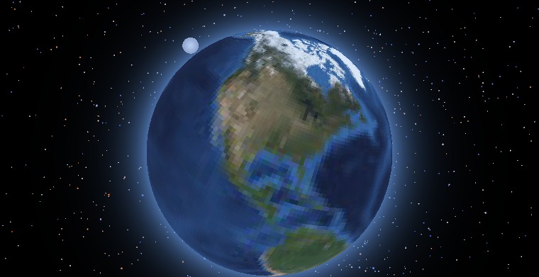
A free-camera view from roughly 7,600 km up, looking almost straight down over the Gulf of Mexico — the whole planet rendered as a sphere, the curve of the horizon falling away into the star field. The same engine that draws street-level voxels renders the entire Earth from satellite imagery and elevation when the camera pulls back to orbital altitude.
Spawn time: 5.5s
Crater Lake caldera
Water bodies + high-relief terrain
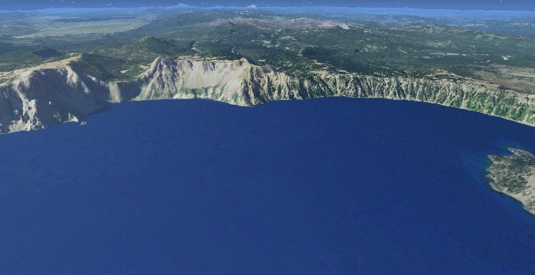
An aerial free-camera view over Crater Lake, Oregon — the deep-blue caldera lake ringed by steep rim cliffs, showing how the engine renders water bodies set into high-relief AWS elevation terrain.
Spawn time: 5.5s
Charleston peninsula from the air
OpenStreetMap building colors + footprints
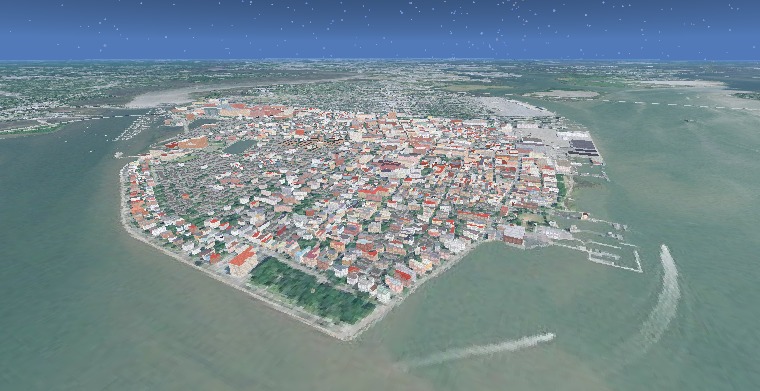
A mid-altitude free-camera view northwest across the Charleston peninsula — the dense grid of OpenStreetMap building footprints raised out of the terrain heightfield, with OSM building:colour / roof:colour tags colouring roofs and walls where mappers recorded them.
Spawn time: 1.5s
Midtown Manhattan from the Hudson
OSM building massing at skyline scale
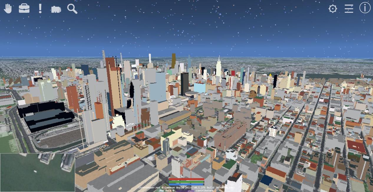
Midtown Manhattan from above the Hudson, looking east across the island — the Hudson Yards rail cut in the foreground, the Empire State Building standing among the midtown towers, and the block grid running away toward the East River. Every building here is OpenStreetMap massing carried by the terrain heightfield itself: the tile mesh holds each mapped footprint's roof height, and building:colour / roof:colour tags colour the roofs and walls where mappers recorded them.
Spawn time: 1.0s
The Chicago Loop across Lake Michigan
OSM water polygons + skyline massing
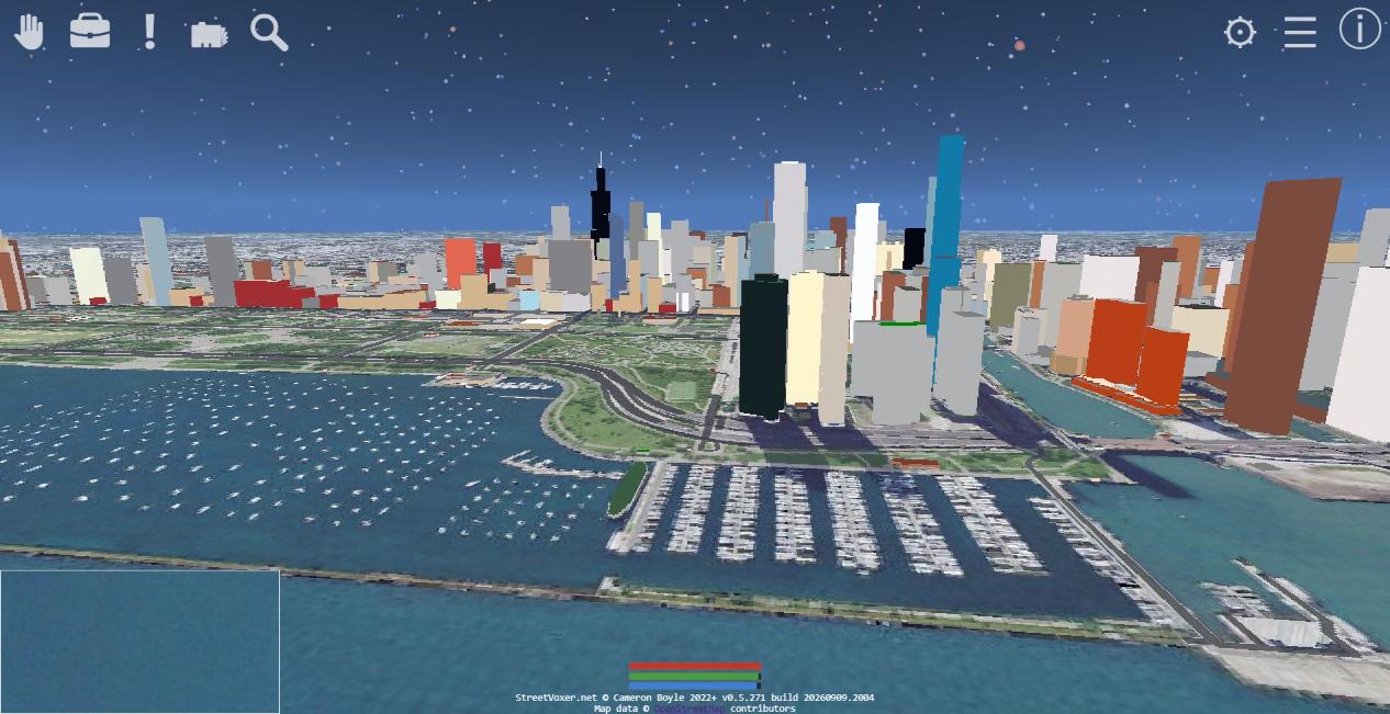
The Chicago Loop seen west across Lake Michigan — Willis Tower breaking the skyline, Grant Park green between the towers and the shore, and the DuSable Harbor marina in the foreground. The lake is an OpenStreetMap water polygon flattened into the terrain mesh, so the shoreline follows the mapped water edge rather than whatever the elevation data happened to say there.
Spawn time: 1.0s
San Francisco's Financial District
Continent-scale OSM coverage
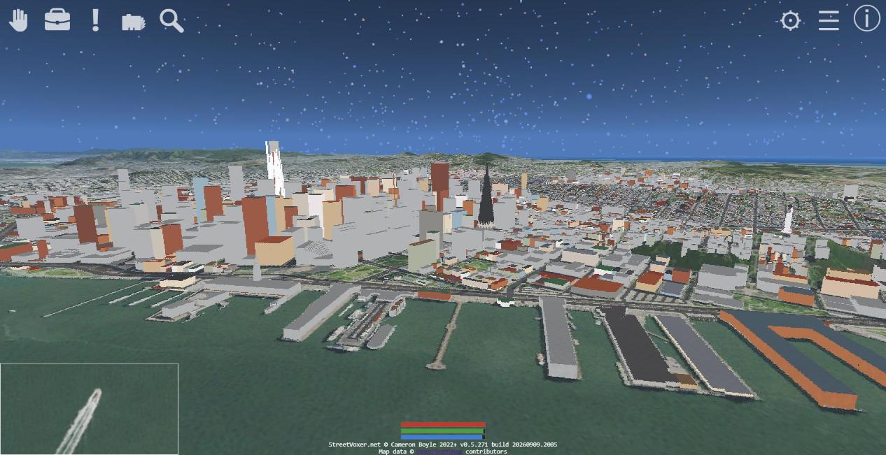
San Francisco's Financial District from over the bay — Salesforce Tower and the Transamerica Pyramid above the downtown blocks, the Embarcadero's finger piers along the waterfront, and the Marin headlands on the horizon. Nothing here is authored per city: one self-hosted OpenStreetMap archive covers North America, and the same code path that draws Charleston draws this.
Spawn time: 1.5s
The French Quarter above the Mississippi
Mapped height, from two storeys to forty
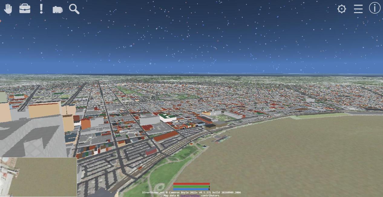
The French Quarter and the Central Business District from above the Mississippi, looking north — the river sweeping across the foreground, the wharves along the levee, and the Quarter's low-rise grid running back from the waterfront. The contrast with the CBD towers at left comes entirely from OpenStreetMap: each footprint is raised by its own mapped height, so a two-storey Creole townhouse and a forty-storey office tower are one data path at different numbers.
Spawn time: 3.0s
Fort Sumter in Charleston Harbor
Coastal OpenStreetMap structures + voxel harbor water
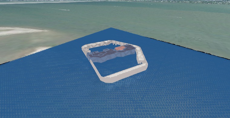
A steep free-camera view down onto Fort Sumter, the masonry sea fort at the mouth of Charleston Harbor where the Civil War began. Close enough to be inside the chunk grid, the fort's pentagonal walls, its interior works and the approach pier are all rendered as ground-scale voxels from OpenStreetMap footprints, ringed by the blue voxel water of the harbour.
Spawn time: 8.0s
Voxel water and tree canopies at Charleston's Battery
Voxel water (OSM carve) + OSM tree canopies + seawall
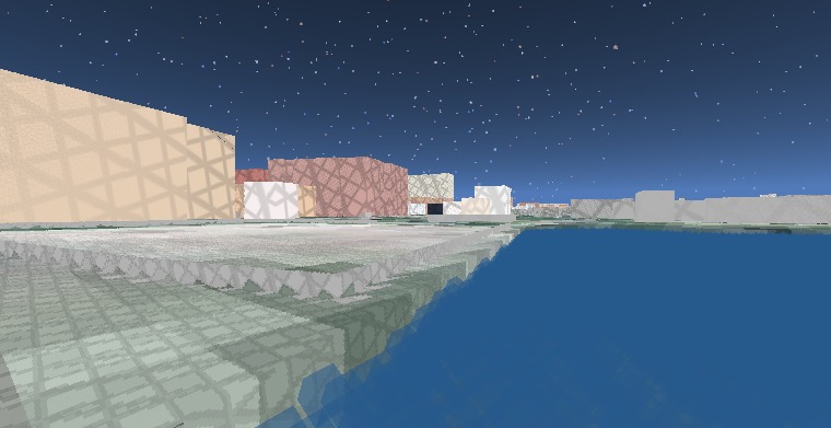
The southern tip of the Charleston peninsula seen from above the water — the seawall of the High Battery running along the point, the park behind it planted with voxel trees, and the harbour lapping at the foot of it all. The water is translucent 1 m voxels filling the basin carved from the OpenStreetMap water polygon; each tree is a single OpenStreetMap natural=tree point grown into a bark-coloured trunk column and a foliage crown quantized to the 1 m voxel grid.
Spawn time: 3.0s
Driving an elevated highway deck
OSM bridge decks (layer-derived raised geometry)
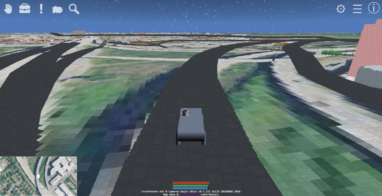
A Humvee stopped on the deck of the elevated US 17 in downtown Charleston, roughly 13 m above the ground, with the neighbouring raised carriageways curving away on either side and open terrain visible beneath them. OpenStreetMap records no height for a bridge — only that a way is a bridge and which layer it stacks on — so the engine derives the deck itself: the interior nodes of each raised way are lifted by the layer number times a fixed clearance, real abutments stay pinned at grade so the ramps meet the road they leave, and a grade-relaxation pass flattens the climb until a vehicle can actually drive it. The near deck is solid voxel geometry you can drive across, and the ground it flies over is left clear and unpainted so you can drive underneath it.
Spawn time: 10.7s
Charleston street level, character mode
Ground-level character view + near-field building voxels
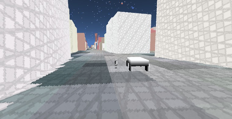
A street-level character-mode view in Charleston's historic district near the Four Corners of Law — the near-field OpenStreetMap buildings lining the block rendered as chunk voxels at ground scale, where the player walks the street under a star-filled sky.
Spawn time: 8.7s